

Home · City Guides · Williamson County · Guides · Tools · Contact
Thompson's Station
Williamson County · Covered by Trey Sugg / Realty ONE Group Music City
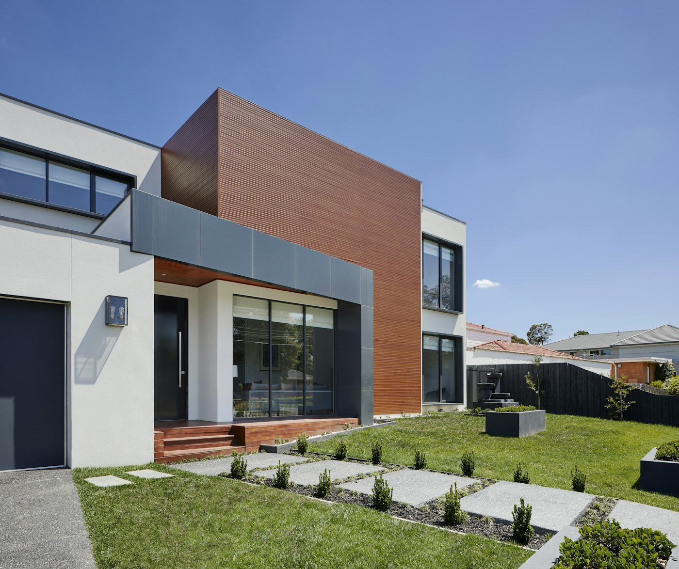
About Thompson's Station
Thompson's Station is a Williamson County town on the south / I-65 edge of Greater Nashville — depot-era Columbia Pike fabric meeting 2000s–2020s master-planned neighborhoods around Tollgate Village, Independence High, and the Goose Creek / Columbia Pike corridor, with Spring Hill and Franklin as everyday neighbors and Nolensville / Fairview as fellow Williamson seats on other corridors. When you cut through the noise, three facts matter more than any brochure headline: (1) the Town of Thompson's Station corporate limits are not the same as ZIP 37179, (2) ZIP 37179 covers the town plus surrounding south-Williamson / mailing spill — never assign schools or taxes by ZIP alone, and (3) Williamson County GNAR Res ~$1.1M is county backdrop only — never the Town of Thompson's Station sold median.
This is Thompson's Station, Tennessee (Williamson) — Census place FIPS 4773900 — research slug thompson-station. Population estimate Jul 1, 2025: 9,469 (+27.2% vs 2020 estimates base 7,444; Census 2020 7,485; Census 2010 2,194). Land area 20.35 sq mi (2020); pop/sq mi 2020 367.9. https://www.census.gov/quickfacts/fact/table/thompsonsstationtowntennessee/PST045225 · Town of Thompson's Station: https://thompsons-station.gov/
Research status: thompson-station-city/ pack is TRULY complete (EVIDENCE-BRIEF + SCHOOLS, EMPLOYERS, RETAIL-MEDICAL, RECREATION, HISTORIC-FAMOUS, BUILDERS_NEW_CONSTRUCTION, NOTABLE_PEOPLE, MAP_PINS + page-sections.json, 2026-09-11). SECTION_ORDER H2s render from the pack payload; this MD keeps the south-Williamson / Columbia Pike / Tollgate / Independence High / ZIP-spill framing.
CRITICAL — Williamson south-side town with ZIP honesty. This same city guide is the source for both Thompson's Station and the Williamson twin path. County context: Williamson County area guide. Neighbor seats and peers: Franklin · Spring Hill · Nolensville · Fairview. Nolensville ZIP 37135 is a separate three-county spill (Williamson + Davidson + Rutherford) on the east-Williamson corridor — neighbor honesty only; do not invent overlap with 37179. Do not publish Williamson County GNAR Res ~$1.1M as the Town of Thompson's Station median.
Corridors: Columbia Pike (US-31) · Tollgate Blvd / Traders Way (Tollgate Village Town Center + Kroger Marketplace) · Clayton Arnold Rd (Thompson's Station ES/MS) · Declaration Way (Independence High) · Bethesda Rd · regional I-65 / Goose Creek Bypass links toward Cool Springs / Franklin / Spring Hill / Nashville. ACS mean commute 30.5 min — a local average, not a timed downtown-Nashville or Cool Springs ETA.
Commute & daily geography
Columbia Pike / Highway 31 and links toward I-65 are the usual routes. Households often compare drive times to Franklin, Cool Springs, and Spring Hill employment — time them at your actual work hours.
Housing notes
Residential growth includes newer subdivisions alongside longer-standing homes. HOA documents and drainage on rolling lots are standard diligence items.
Commute corridors
Columbia Pike (US-31) · Tollgate Blvd / Traders Way · Clayton Arnold Rd · Declaration Way · Bethesda Rd · regional I-65 / Goose Creek Bypass links toward Cool Springs / Franklin / Spring Hill / Nashville. ACS mean commute 30.5 min — a local average, not a fixed downtown Nashville ETA. Drive peak I-65 / Columbia Pike toward Cool Springs / Franklin / Nashville at your actual work hours before you commit. A 37179 mailing does not tell you whether the house is inside town limits. Neighbor Nolensville is east-Williamson (37135 three-county spill — different ZIP); Fairview is west-Williamson Hwy 100 — peer seats, not the same corridor.
Buy / sell — short diligence
- Town limits vs ZIP first: Town of Thompson's Station corporate limits ≠ ZIP 37179. ZIP 37179 = town + surrounding south Williamson / mailing spill — never assign schools or taxes by ZIP alone.
- Schools: WCS for Town addresses (Independence High GS 10/10; TSMS 9/10; Heritage MS 9/10; TSES 9/10; Heritage ES 7/10; Bethesda ES 8/10 — live GS 2026-09-11). Zone tools, never ZIP. Fairhaven marketing citing Summit High = confirm parcel. Private in-town campus = GAP; nearest named private often Grace Christian (Franklin).
- Market grain: Realtor town sold $820,000 (Aug 2026) + Resideline sample $860,000 (6-mo ~Sep) are labeled CONFLICT town grains; Redfin search-index ~$851K is unconfirmed live; ACS $700,500 ≠ sale; Realtor town rent $3,800 vs ZIP-rent table $2,650 = within-portal CONFLICT; GNAR Williamson Res (~$1.1M) is county backdrop only — never Town sold.
- Sarah Benson Park is the signature municipal park — closed for playground construction expected complete by end of 2026 (town site).
- HOA/CC&Rs on masterplans (Tollgate, Parson's Valley, Fairhaven, and any other PUD stock) and rental caps if any.
- Flood / drainage notes on low-ground / creek-adjacent parcels — verify per address.
- New-construction vs resale: builder incentives and lot premiums change; confirm warranty; never trust builder school auto-suggests without parcel verify (especially 37179 mailing outside town; Fairhaven → Summit HS marketing).
- Town vs county services; Williamson Trustee tax bill for Town parcels; unincorporated south Williamson on some 37179 mailings.
- Listing geography: 37179 dominates portals but blends town + rural — prefer town portal framing + assessor / town GIS. Do not treat Realtor Franklin-side neighborhood names as town neighborhoods.
- Retail everyday: Publix + Kroger Marketplace + Ace Hardware in town at Tollgate / Traders Way; Target / Costco / Sam’s / Walmart Supercenter / Starbucks-count in town = GAP; nearest Costco Brentwood; nearest Target/Sam’s Franklin.
- Hospital: no in-town acute flagship this pass — Williamson Medical Center is Franklin. Tennessee Equine Hospital is not a human hospital.
- Cross-shop Franklin · Spring Hill · Nolensville · Fairview · Williamson County — Nolensville 37135 is a separate three-county ZIP spill (neighbor honesty only; do not invent overlap with 37179).
Whether you’re comparing a Parson's Valley Beazer townhome to a Fairhaven gated new-build, shopping Tollgate Village against a Columbia Pike acreage parcel, or weighing an Independence High zone against a Summit High marketing claim on a Fairhaven lot — let’s walk through the address-level details. I’ll keep watching these town vs ZIP vs county numbers so you don’t mix them.
Housing / market
Owner-occupied rate 81.3%; ACS median owner-occupied value $700,500 (ACS 2020–2024) — stock value, not a current MLS or portal sale median. Median gross rent $2,088; median selected monthly owner costs with mortgage $2,645 (without $746); households 2,906; persons/HH 2.85; land area 20.35 sq mi (2020). https://www.census.gov/quickfacts/fact/table/thompsonsstationtowntennessee/PST045225
Stock mix (qualitative): heavy 2000s–2020s master-planned SFH + TH/condo pockets (Tollgate Village / Parson's Valley / Fairhaven corridor) + older Columbia Pike / depot-era fabric + acreage fringe. ACS structure-type shares · QuickFacts housing units / permits: GAP. Parcel town limits vs unincorporated 37179: confirm via assessor / town GIS — never by ZIP (ZIP 37179 = town + surrounding south Williamson / mailing spill).
Portal sale / listing stats — thompson-station-city pack (2026-09-11). Aggregators = SECONDARY (not Realtracs / GNR MLS). Dual town grains labeled; do not blend. Redfin live HTML blocked this pass (search-index SECONDARY only). Realtracs-primary typed SFH/condo-TH/land bands: GAP.
- Median sold (Realtor town): $820,000 (+0.61% YoY) — Aug 2026 — https://www.realtor.com/local/market/tennessee/williamson-county/thompsons-station
- Median listing (Realtor): $865,445 (−9.20% YoY) · Active 454 (+44.25%) · Median DOM list 41 (−1.82%) · Median rent $3,800/mo (+13.43%) — ZIP-rent table on same page shows 37179 rent $2,650 (CONFLICT within portal)
- Median sold (Resideline sample): $860,000 (150 closings; middle half $657,500–$1,165,000) · $/sqft $304 · list→UC 48 days — 6-mo thru ~Sep 2026 — https://resideline.com/blog/thompsons-station-tn-housing-market
- Median sale (Redfin search-index unconfirmed live): ~$850,717 (+0.7% YoY claim) · ~75 DOM — ~3-mo ending ~Jun 2026 — https://www.redfin.com/city/18788/TN/Thompson-s-Station/housing-market — do not publish as confirmed without re-fetch
- ACS owner value $700,500 · ACS rent $2,088 — ACS ≠ portal sale
CONFLICT: Realtor Aug sold $820,000 / DOM list 41 vs Resideline sample $860,000 / list→UC 48 vs Redfin index ~$851K — never average. ACS $700,500 ≠ sale. Realtor Franklin-side neighborhood names on town page ≠ Thompson's Station town neighborhoods.
County backdrop only — never Town of Thompson's Station: GNAR Williamson Res Q2 2026 $1,101,242 / Q1 $1,065,000; Condo Q2 $525,000 / Q1 $475,000 (https://www.greaternashvillerealtors.org/market-data-quarterly). Never publish ~$1.1M as Thompson's Station town sold.
What homes cost here: Realtor $820,000 + Resideline $860,000 labeled CONFLICT. Typed SFH/condo/land/new-vs-resale town MLS bands: GAP. Builder marketing floors (not sold): Beazer Parson's Valley from $469,990; Dream Finders Fairhaven from $949,990; Emberly sold out claim.
Who’s moving in
Town (Census QuickFacts / PEP V2025, as-of 2026-09-11): Population estimate Jul 1, 2025 9,469 — +27.2% vs 2020 base 7,444 (Census 2020 7,485; Census 2010 2,194). Same house 1 year ago 84.2%; foreign-born 6.4%; language other than English (5+) 11.1%; under 18 26.9%; under 5 8.1%; 65+ 12.4%; mean commute 30.5 min; bachelor’s+ (25+) 61.9%; HS graduate+ 97.1%; median household income $132,647; per capita $62,985; poverty 3.5%; labor force 16+ 71.0%; White alone 85.7%; Asian alone 6.1%; Hispanic or Latino 4.3%; owner-occupied 81.3% (ACS 2020–2024 / QuickFacts). https://www.census.gov/quickfacts/fact/table/thompsonsstationtowntennessee/PST045225
County / metro context (labeled — not town substitutes):
- Williamson County MSA net-migration → Williamson area guide (`MIGRATION-TRENDS.md`) — not a Town substitute
- ACS town-only migration origin flows: GAP
- Timed I-65 / Columbia Pike / Goose Creek Bypass peak ETA to Cool Springs or downtown Nashville: GAP (ACS mean ≠ peak drive time)
- Neighbor honesty: Franklin · Spring Hill · Nolensville (37135 three-county spill — separate ZIP; do not invent overlap with 37179) · Fairview
Schools
Williamson County Schools (WCS) serves PreK–12 for Town of Thompson's Station addresses. ZIP 37179 often includes unincorporated south Williamson — never assign schools by ZIP. WCS HQ 1320 West Main Street Suite 202, Franklin, TN 37064 · (615) 472-4000 · https://www.wcs.edu/ · Zones: https://www.wcs.edu/about-us/school-zones · PDF https://docs.wcs.edu/pdf/transportation/WCS-School-Zone-Map.pdf. WCS ~42,000/52 schools vs GS index ~41,593/53 — CONFLICT; cite source.
GreatSchools live 2026-09-11 (prefer live over earlier MOVERS IHS 9/10 — live = 10/10; prefer live over Realtor cards TSES 8 / Heritage ES 6 / Bethesda 7):
- Independence High — 1776 Declaration Way — 10/10 — 2,091 — https://www.greatschools.org/tennessee/thompson's-station/2471-Independence-High-School/
- Thompson's Station Middle — 2638 Clayton Arnold Rd — 9/10 — 579 — https://www.greatschools.org/tennessee/thompson's-station/6711-Thompsons-Station-Middle-School/
- Heritage Middle — 4803 Columbia Pike — 9/10 — 847 — https://www.greatschools.org/tennessee/thompson's-station/2135-Heritage-Middle-School/
- Thompson's Station Elementary — 2640 Clayton Arnold Rd — 9/10 — 767 — https://www.greatschools.org/tennessee/thompson's-station/6710-Thompsons-Station-Elementary-School/
- Heritage Elementary — 4801 Columbia Pike — 7/10 — 585 — https://www.greatschools.org/tennessee/thompson's-station/2107-Heritage-Elementary-School/
- Bethesda Elementary — 4907 Bethesda Rd — 8/10 — 561 — https://www.greatschools.org/tennessee/thompson's-station/1554-Bethesda-Elementary-School/
Do not invent one feeder ladder for every address. Fairhaven marketing cites Bethesda ES / TSMS / Summit High (Spring Hill) — confirm with zone tools. Private campus inside Town: GAP. Nearest named private often compared: Grace Christian Academy — 3265 Southall Rd, Franklin — https://www.gcalions.com/ — no invented tuition.
Industries / employers
Residential / education / retail-service town inside Williamson labor shed. Named presence (place-level FTE table = GAP; large manufacturer HQ inside town = GAP):
- Town of Thompson's Station — 1110 Fountain View Blvd · https://thompsons-station.gov/
- WCS campuses — Independence High + Heritage ES/MS + Thompson's Station ES/MS + Bethesda ES (large local public-sector footprints)
- Tollgate Village Town Center retail / service cluster — 2011 Tollgate Blvd
- Kroger Marketplace — 4726 Traders Way
- Homestead Manor — 4683 Columbia Pike · events / hospitality
- Tennessee Equine Hospital — specialty equine (not human hospital)
- Economic Census 2022 (QuickFacts): retail sales $110.259M; transportation & warehousing $108.688M; health care & social assistance $17.136M; accommodation & food $6.398M
Commute backdrop (ASSUMPTION geography only): Cool Springs (Franklin), GM Spring Hill Assembly (Maury — not town), Nashville via I-65 — not Town employers. Do not place Nissan Smyrna, CoolSprings Galleria, or Maryland Farms HQs as Thompson's Station employers.
Retail & everyday
In-town grocery is real; Target / Costco / Sam’s / Walmart Supercenter inside Town of Thompson's Station = GAP — nearest Cool Springs / Brentwood / Franklin / Spring Hill. Starbucks street-complete count GAP (White Shepherd Coffee + Settlers Coffee named at Tollgate).
- Publix Tollgate Village — Tollgate Village / Columbia Pike & Tollgate Blvd
- Kroger Marketplace — 4726 Traders Way · (615) 791-5346
- Tollgate Village Town Center — 2011 Tollgate Blvd — Mojo's Tacos · Village Pizza · White Shepherd / Settlers coffee · Ace Hardware · Stretch Zone · Station 34 Pilates · Wilco Dentistry · Strong Health and Wellness (Regent page 2026-09-11)
- Homestead Manor — 4683 Columbia Pike (events / venue coffee — not grocery)
- Target Cool Springs — 1701 Galleria Blvd, Franklin (nearest)
- Costco Brentwood — 98 Seaboard Ln (nearest)
- Sam’s Club Franklin — 3070 Mallory Ln
Hospitals & medical
Hospital in town: GAP — none sourced inside Town of Thompson's Station.
Williamson Medical Center (nearest major) — 4321 Carothers Parkway, Franklin, TN 37067 — Franklin / Williamson flagship · https://williamsonhealth.org/ · see Franklin
Tennessee Equine Hospital — Thompson's Station corridor — specialty equine veterinary — not a human hospital (across from Sarah Benson Park).
Wilco Dentistry + Strong Health and Wellness named at Tollgate = FACT clinics. Full urgent-care / specialty roster: GAP. Health care receipts (place Economic Census 2022): $17.136M.
Parks & trails
Signature municipal amenity is Sarah Benson Park — currently CLOSED for new playground construction expected complete by end of 2026. Full commercial gym inventory: GAP beyond named Tollgate studios — gyms H2 omitted. Station 34 Pilates / Stretch Zone are Tollgate tenants (see Retail); Tollgate pool/fitness/tennis = HOA amenities. Large public municipal rec center inside town: GAP.
- Sarah Benson Park — ~27 acres; renamed 2017; jogging paths, fields, pavilions/stage, Mars Dog Sensory Garden, Alexander Trail connection claim — CLOSED for playground / parking / shade / stormwater work thru ~end 2026 · https://www.thompsons-station.gov/departments/parks-and-recreation/park-information-and-trail-maps/sarah-benson-park
- Preservation Park / Nutro Dog Park / Preservation Pavilion — town-listed; exact street numbers GAP
- Alexander Trail — bikes permitted on Alexander Trail only (town rule); full greenway mile table GAP
Historic & famous places
Depot / Civil War battlefield / Homestead Manor corridor — not a Battle of Franklin site dump. Carter House / Carnton / Lotz / Franklin Square = Franklin — do not relocate.
- Town Hall / Depot replica — 1110 Fountain View Blvd — named for Dr. Elijah Thompson land gift; 1866 depot / dismantled 1952 / 1993 replica · https://thompsons-station.gov/town-history/re-building-depot · HMDB m=75125
- Battle of Thompson's Station — March 5, 1863 (Van Dorn / Forrest vs Coburn) · https://www.thompsons-station.gov/town-history/battle-thompsons-station · https://www.battlefields.org/learn/civil-war/battles/thompsons-station
- Homestead Manor — 4683 Columbia Pike — early 19th-c estate / battlefield association / modern events · homesteadmanor.com
Timeline: Early 1830s–1836 White House / Littlebury · 1856 naming · 1863-03-05 battle · 1866 / 1952 / 1993 depot cycle. NRHP / exact battlefield acreage / interpretive marker coords beyond Homestead / HMDB: GAP.
Builders & new construction
Named selling communities only (builder PRIMARY, as-of 2026-09-11). Marketing floors ≠ MLS sold bands. Do not invent subdivisions. ZIP 37179 mailing ≠ town limits / WCS — confirm lot jurisdiction before school claims (Fairhaven marketing cites Summit High — Spring Hill).
- Beazer — Parson's Valley — selling; from $469,990 (townhomes + solar-included SFH; Estate + Summit); sales 5219 Gerhard Drive — https://www.beazer.com/nashville-TN/thompsons-station/parsons-valley
- Dream Finders — Fairhaven — selling; from $949,990; gated; plans ~2,658–6,752 sq ft; 5000 Fairhaven Circle — https://dreamfindershomes.com/new-homes/tn/thompsons-station/fairhaven/
- Regent — Tollgate Village Town Center — active community / confirm lot inventory; sales 2011 Tollgate Blvd — https://www.regenthomestn.com/communities/nashville-tn/nashville-tn/tollgate-village-town-center
Not elevated as selling: Dream Finders Emberly — builder page sold out claim. Bridgemore / Whistle Stop / Fountain View / The Hills / Avenue Downs / Littlebury / Brixworth / Cherry Grove — SECONDARY agent-blog until builder primary confirms status=selling.
Notable people
Corroborated ties only (Research NOTABLE_PEOPLE.md, 2026-09-11) — dual-source preferred; never stretch celebrity listicles.
- Dr. Elijah Thompson (b. 1805, Campbell Co., VA) — Namesake land donor (1856); physician (M.D. Transylvania 1830), planter, Tennessee state legislator. https://thompsons-station.gov/town-history · https://thompsons-station.gov/town-history/historical-timeline · HMDB depot marker
- Alice Thompson (Alice J. Thompson Dungan, 1846–1870) — Daughter of Dr. Elijah Thompson; Battle of Thompson's Station (Mar 5, 1863) flag episode near Homestead Manor / Banks residence. https://www.battlefields.org/learn/civil-war/battles/thompsons-station · town battle page
Rejected / deferred: contemporary entertainers/athletes (GAP); Forrest / Van Dorn / Coburn = battle commanders, not town residents for notables; mayoral/commissioner names as “famous” (officeholders).
Map of local places
- Independence High School — 1776 Declaration Way, Thompson's Station, TN 37179
- Thompson's Station Elementary School — 2640 Clayton Arnold Road, Thompson's Station, TN 37179
- Thompson's Station Middle School — 2638 Clayton Arnold Road, Thompson's Station, TN 37179
- Heritage Elementary School — 4801 Columbia Pike, Thompson's Station, TN 37179
- Heritage Middle School — 4803 Columbia Pike, Thompson's Station, TN 37179
- Bethesda Elementary School — 4907 Bethesda Road, Thompson's Station, TN 37179
- WCS HQ — 1320 West Main Street Suite 202, Franklin, TN 37064
- Town of Thompson's Station Town Hall / Depot — 1110 Fountain View Blvd, Thompson's Station, TN 37179
- Homestead Manor — 4683 Columbia Pike, Thompson's Station, TN 37179
- Sarah Benson Park — Sarah Benson Park, Thompsons Station Road West, Thompson's Station, TN 37179
- Tollgate Village Town Center / Regent — 2011 Tollgate Blvd, Thompson's Station, TN 37179
- Publix Tollgate Village — Publix Tollgate Village, Thompson's Station, TN 37179
- Kroger Marketplace Thompson's Station — 4726 Traders Way, Thompson's Station, TN 37179
- Parson's Valley (Beazer) sales center — 5219 Gerhard Drive, Thompson's Station, TN 37179
- Fairhaven (Dream Finders) — 5000 Fairhaven Circle, Thompson's Station, TN 37179
- Grace Christian Academy (nearest private — Franklin, not Thompson's Station town) — 3265 Southall Road, Franklin, TN 37064
- Williamson Medical Center (nearest hospital — Franklin) — 4321 Carothers Parkway, Franklin, TN 37067
- Costco (nearest — Brentwood) — 98 Seaboard Lane, Brentwood, TN 37027
- Target Cool Springs (nearest Target — Franklin) — 1701 Galleria Blvd, Franklin, TN 37067
- Sam's Club Franklin (nearest) — 3070 Mallory Lane, Franklin, TN 37067
- Tennessee Equine Hospital (specialty — not human hospital) — Tennessee Equine Hospital, Thompson's Station, TN 37179
Places from Research MAP_PINS (FACT). Verify hours and visitation rules. Pins also appear on the map when coordinates are filed.
Map
Thompson's Station on the map
Interactive OpenStreetMap. Amenity pins appear when Research files MAP_PINS. Verify schools and flood zones per address.
Map data © OpenStreetMap contributors
Places on this map
- Independence High School — 1776 Declaration Way, Thompson's Station, TN 37179
- Thompson's Station Elementary School — 2640 Clayton Arnold Road, Thompson's Station, TN 37179
- Thompson's Station Middle School — 2638 Clayton Arnold Road, Thompson's Station, TN 37179
- Heritage Elementary School — 4801 Columbia Pike, Thompson's Station, TN 37179
- Heritage Middle School — 4803 Columbia Pike, Thompson's Station, TN 37179
- Bethesda Elementary School — 4907 Bethesda Road, Thompson's Station, TN 37179
- WCS HQ — 1320 West Main Street Suite 202, Franklin, TN 37064
- Town of Thompson's Station Town Hall / Depot — 1110 Fountain View Blvd, Thompson's Station, TN 37179
- Homestead Manor — 4683 Columbia Pike, Thompson's Station, TN 37179
- Sarah Benson Park — Sarah Benson Park, Thompsons Station Road West, Thompson's Station, TN 37179
- Tollgate Village Town Center / Regent — 2011 Tollgate Blvd, Thompson's Station, TN 37179
- Publix Tollgate Village — Publix Tollgate Village, Thompson's Station, TN 37179
- Kroger Marketplace Thompson's Station — 4726 Traders Way, Thompson's Station, TN 37179
- Parson's Valley (Beazer) sales center — 5219 Gerhard Drive, Thompson's Station, TN 37179
- Fairhaven (Dream Finders) — 5000 Fairhaven Circle, Thompson's Station, TN 37179
- Grace Christian Academy (nearest private — Franklin, not Thompson's Station town) — 3265 Southall Road, Franklin, TN 37064
- Williamson Medical Center (nearest hospital — Franklin) — 4321 Carothers Parkway, Franklin, TN 37067
- Costco (nearest — Brentwood) — 98 Seaboard Lane, Brentwood, TN 37027
- Target Cool Springs (nearest Target — Franklin) — 1701 Galleria Blvd, Franklin, TN 37067
- Sam's Club Franklin (nearest) — 3070 Mallory Lane, Franklin, TN 37067
- Tennessee Equine Hospital (specialty — not human hospital) — Tennessee Equine Hospital, Thompson's Station, TN 37179
From Research MAP_PINS. Links open Google Maps.
Property search
Search listings near Thompson's Station
RealScout search tied to my Middle Tennessee listings feed.
Talk through Thompson's Station
Call or text 615-943-1644, use the tools, or contact me.
General informational purposes only — not an appraisal, and not legal, tax, insurance, or lending advice. Flood zones, HOA rules, school assignments, and property conditions must be verified per address. Detailed amenity/market sections appear only when a rich Research area pack is complete. City boundaries follow Tennessee’s official city list.
← All city guides · Williamson County · Free guides · Tools · Contact